The Lonely Backcountry Lakes of the Emigrant Wilderness
 We checked our maps and figured that we just might be able to find a route up over the ridge to our north and get to Leighton Lake. We gave it a shot, following a wonderful sloping ramp up to a bench, and then exploring for about 45 minutes how to get off that bench over the last 150 feet of elevation we needed to get up to Leighton.
 And we failed. Yeah, there were a couple of places that might have worked, but it was definitely class 3+…and we don’t like to do that with full packs on. But as we sat down to admire the view and decide what to do next, we noticed Five Acre Lake below us.
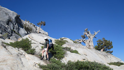
That's M, above, staring at the end of the line.
Perfect. We slipped, scrambled, and followed deer trails down to a perfect little lake with ideal campsite and tons of rising fish. After a long (and at times frustrating) day on the trail, it was heaven. By the time we were done, we figured we hiked another 8 or 9 miles on day two…and had adventures we would remember for a lifetime. We hadn’t seen anyone at all since breakfast at Resasco Lake.That evening we got out our topos, and figured we could probably get to Leighton from Five Acre, if we followed a different ramp…and then turned hard left back along the bench that runs between Leighton and Red Can Lakes. And if we couldn’t do that by about 11 a.m.; then it was time to go back the other way, and backtrack to Big Lake and out.
But by 9:30 we had found an easy route up the ramp, climbed a short but very steep notch up over the last granite wall, and found a series of ducks leading us forward. Within a couple of minutes we were at Red Can Lake (not Red Canyon, which is what it is called on the National Geographic topo Map!) and from there it was an easy walk over to Leighton.

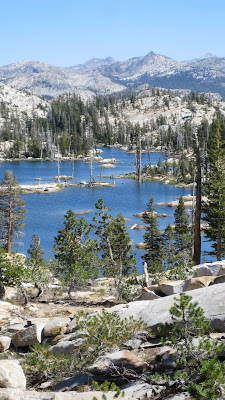
We spent the rest of the morning enjoying the view from the southern edge of Leighton Lake (which overlooks all that territory we had just clambered around on…as well as a clear shot to the Sierra crest) and then walking up the west side of nearby Karl’s Lake. Camped there and took the afternoon to hike out about a mile past the west end of Leighton Lake to Kole Lake—and from there saw a clear route back to Pingree Lake, where we had been two days before. That's Leighton Lake, on the right, as seen from our hike back from Kole Lake.
That evening we climbed the little knob west of the lake, to take the familiy portrait you see at left...
The last day was pretty straightforward---a hike out from Karl’s Lake to the main trail at Wood Lake… less than a mile…and then straight back to the trailhead for ten miles. By 3:45 we were back at the car, and by 5:45 we were eating dinner and enjoying a cold beer. And our conversation over dinner was about how crazy people are.
This was Labor Day Weekend, but we were amazed that we only saw that one group of campers at Resasco Lake…and didn’t run into anyone else until we got to within about two miles of the trailhead. Then all hell broke loose---it was like Grand Central Station. Pack trains, dads with little kids, single men with dogs, large groups of hikers, young couples…all going in or coming out…but all staying within four miles of the trailhead. Parking at the trailhead was more than full…but we didn’t see a soul for three days.
This was a great hike—the route finding was not really hard, and with a few exceptions, the routes were pretty darn comfortable. The off-trail just added a bit of fun and adventure…and the time together was priceless.

No comments:
Post a Comment